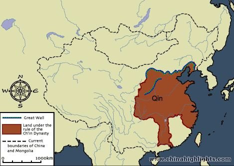
Map of China during Qin dynasty
 http://mumbsen.blogspot.com/
This is a map that shows the borders of China during the Qin dynasty and the borders of current day China. The Yangtze river was an important river that flowed through the center of the Qin dynasty area. The area was also on the coast. These two sources of water made it easier to trade and import/export products with other countries. A major man-made landmark was the Great Wall of China which protected the Qin dynasty area from invaders of the north. The rivers and borders are part of what helped China expand throughout history.
No comments:
Post a Comment